Demography
Population (2011)
100,882
Census 2011
Area
2451.0 Ha
24.51 sq.km
Gross Density
41 PPH
Persons per Hectare
Wards/Villages
4
Within BBMP
South-west BMA. 4 wards (2 full, 2 part). 119% decadal growth. Global Village SEZ, Kengeri Satellite Town, Rajarajeshwari Nagar, Banashankari 6th Stage, Jnanabharti. Mysore Road, NICE abuts west/south. 15 slums (10,325 people). 61 schools; BGS, RVCE. 42% water, 26% sewage.
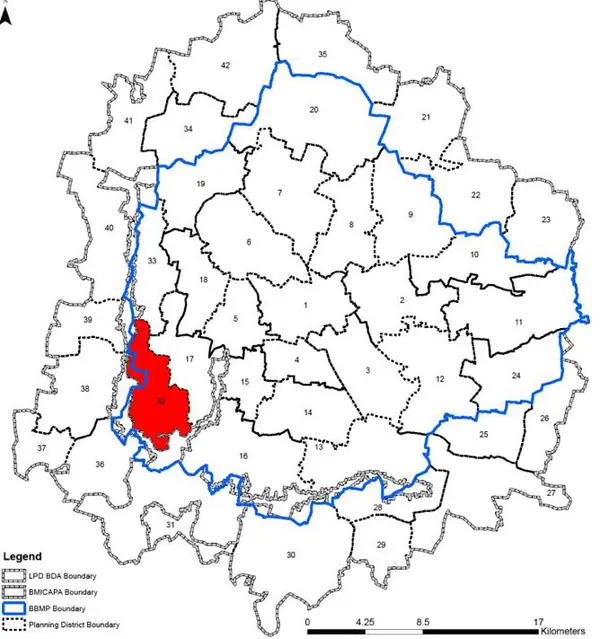
part) Gross Density: 41.15 pph The Planning District 32, Ullalu-Kengeri is located at south west of the BMA planning area. The Vrishabhavathi River flows through the PD, rendering several areas in this PD, ecologically sensitive. The PD is bounded by BMIC (NICE) along the West and South and shares its boundary with BMICAPA area and the NICE Corridor. The Revised Master Plan 2031 proposes densification of the residential areas in a planned manner along with increased public transport share and other transit integration and infrastructure upgradation.
1. The Ullalu- Kengeri Planning District comprises of 4 wards in total. The wards being two wards Ullalu (130) and Kengeri (159); partly in BMIC, one village (Kengeri Gollahalli) and western part of Hemmigepura ward (198).
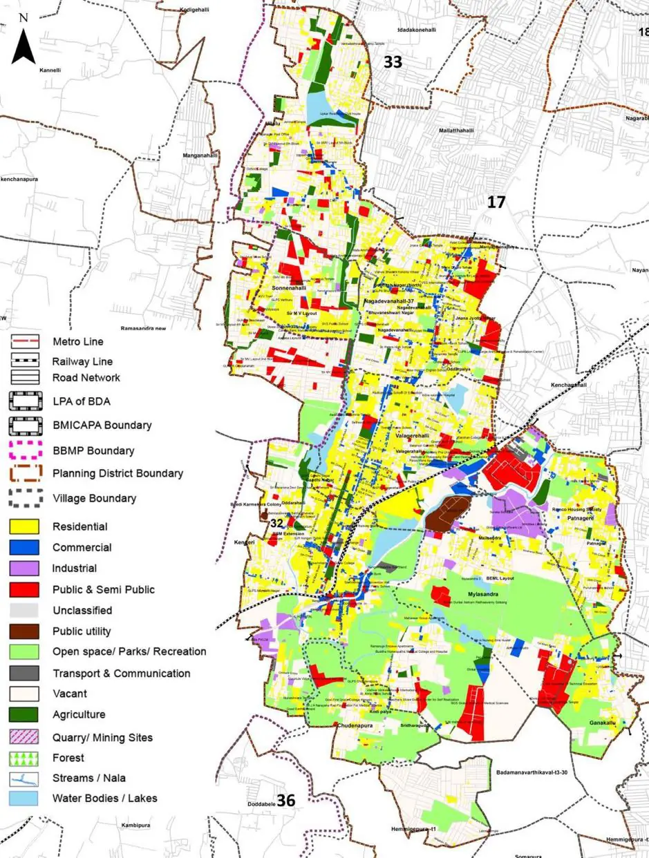
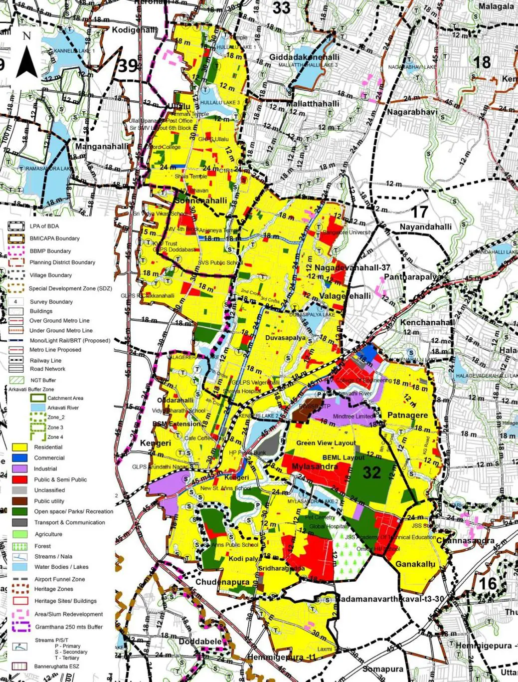
The Existing Land Use Map and Proposed Land Use Map for this PD are in the Planning District Report (PDF). Open the document and go to this PD’s section; use the List of Figures to find “PD 32 Existing Land Use Map” and “PD 32 Proposed Land Use Map”.
| Land use Category | Area (in Ha) | Percentage to Total Area (%) |
|---|---|---|
| Residential | 424.61 | 17.32 |
| Commercial | 61.52 | 2.51 |
| Industrial | 50.25 | 2.05 |
| Quarry/ Mining Sites | 0.00 | 0.00 |
| Public & Semi Public | 94.41 | 3.85 |
| Unclassified | 0.00 | 0.00 |
| Public Utility | 14.95 | 0.61 |
| Parks & Open Spaces | 34.80 | 1.42 |
| Transport & Communication | 232.11 | 9.47 |
| Vacant | 990.20 | 40.40 |
| Agriculture | 469.12 | 19.14 |
| Forest | 0.00 | 0.00 |
| Streams | 0.00 | 0.00 |
| Water Bodies | 58.58 | 2.39 |
| NGT Buffer | 0.00 | 0.00 |
| Other | 20.59 | 0.84 |
| Total | 2451.00 | 100.00 |
| Land use Category | Area (in Ha) | Percentage To Total Developable Area (%) |
|---|---|---|
| Residential | 1292.90 | 52.75 |
| Commercial | 25.74 | 1.05 |
| Industrial | 65.93 | 2.69 |
| Quarry/ Mining Sites | 0.00 | 0.00 |
| Public & Semi Public | 166.42 | 6.79 |
| Unclassified | 0.00 | 0.00 |
| Public Utility | 12.50 | 0.51 |
| Parks & Open Spaces | 166.18 | 6.78 |
| Transport & Communication | 324.02 | 13.22 |
| Vacant | 0.00 | 0.00 |
| Agriculture | 0.00 | 0.00 |
| Forest | 40.93 | 1.67 |
| Streams | 0.00 | 0.00 |
| Water Bodies | 52.21 | 2.13 |
| NGT Buffer | 283.93 | 11.58 |
| Other | 20.09 | 0.82 |
| Total Developable Area | 2450.85 | , |
Total PD Area 2451.00 Ha. Source: Revised Master Plan 2031 (Draft) Volume-4.
Road Development Plan, Public Transport System, Multimodal Interchange Stations, Parks and Open Spaces, Protection and Rejuvenation of Lakes and Streams, Area Redevelopment, Heritage Area Protection and Conservation, Physical Infrastructure, Disaster Mitigation.