Demography
Population (2011)
787,560
Census 2011
Area
1806.6 Ha
18.07 sq.km
Gross Density
436 PPH
Persons per Hectare
Wards/Villages
23
Within BBMP
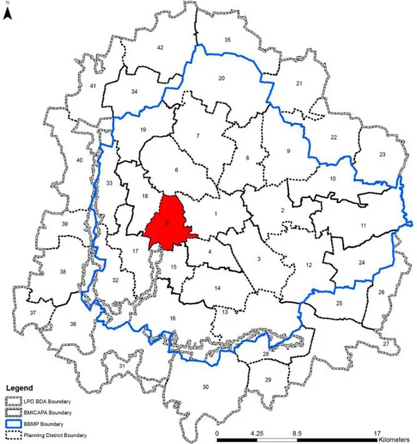
Largest PD by population within BBMP. Dense residential areas, industrial estates (Binny Mills, Minerva Mills, BHEL), and BDA planned layouts. Highest density ward: Padarayanapura at 1213 pph.
RAJAJI NAGAR–BAPUJI NAGAR–AZAD NAGAR
1. In this PD, there are a total of 23 wards namely - Rajaji Nagar (99), Basaveshwara Nagar (100), Dr.Rajkumar Ward (106), Shiva Nagar (107), Sri Rammandira (108), Binnipet (121), Kempapura Agrahara (122), Maruthi Mandira Ward (126), Padarayanapura (135), Jagareevanram Nagar (136), Rayapuram (137), Chalavadipalya (138), Chamarajpete (140), Azad Nagar (141) in the Bangalore West Zone of the BBMP and Govindraja Nagara (104), Agrahara Dasarahalli (105), Gali Anjaneya Swamy Temple Ward (157), Vijay Nagar (123), Hosahalli (124), Marenahalli (125), Attiguppe (132), Hampi Nagar (133), Bapuji Nagar (134).
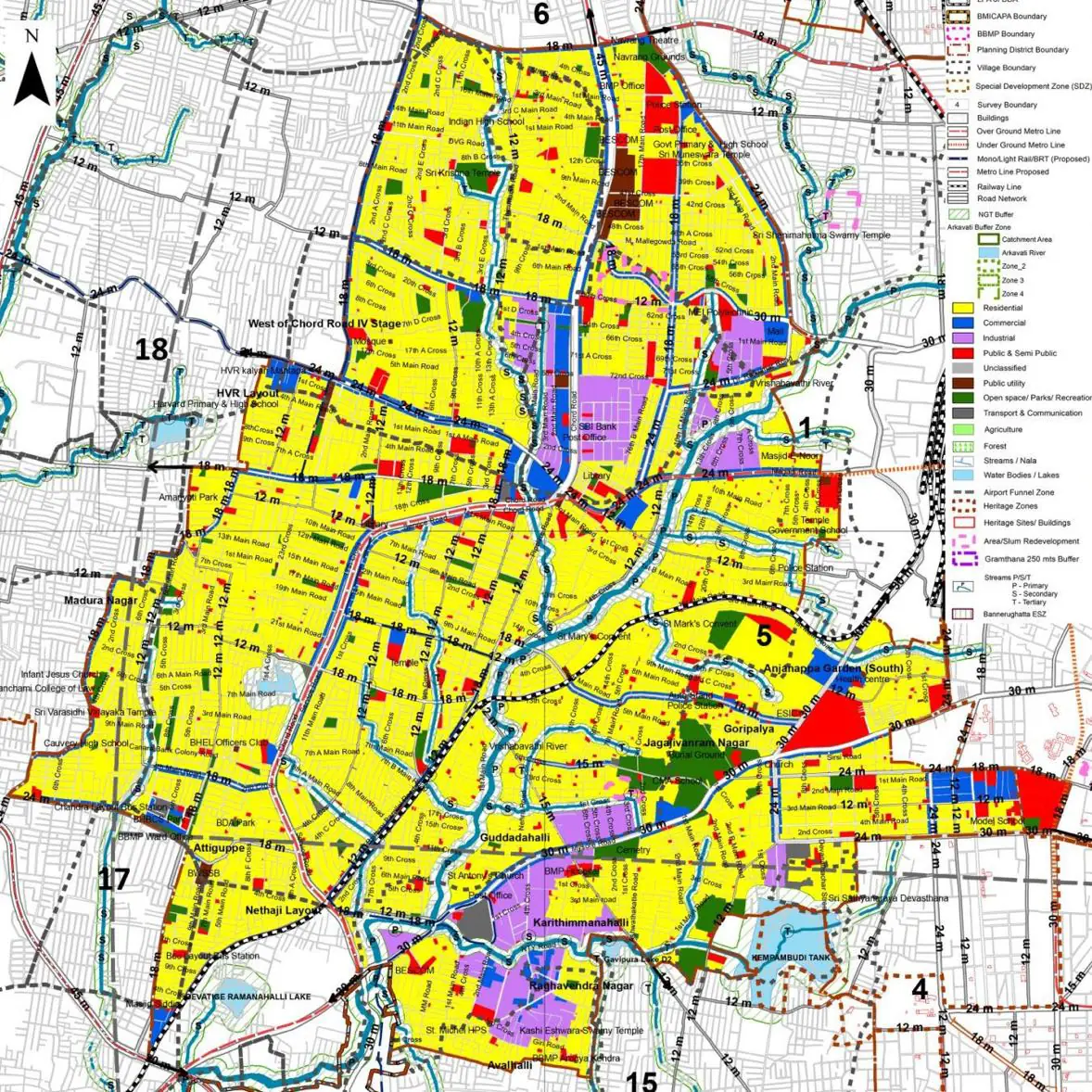
The Existing Land Use Map and Proposed Land Use Map for this PD are in the Planning District Report (PDF). Open the document and go to this PD’s section; use the List of Figures to find “PD 5 Existing Land Use Map” and “PD 5 Proposed Land Use Map”.
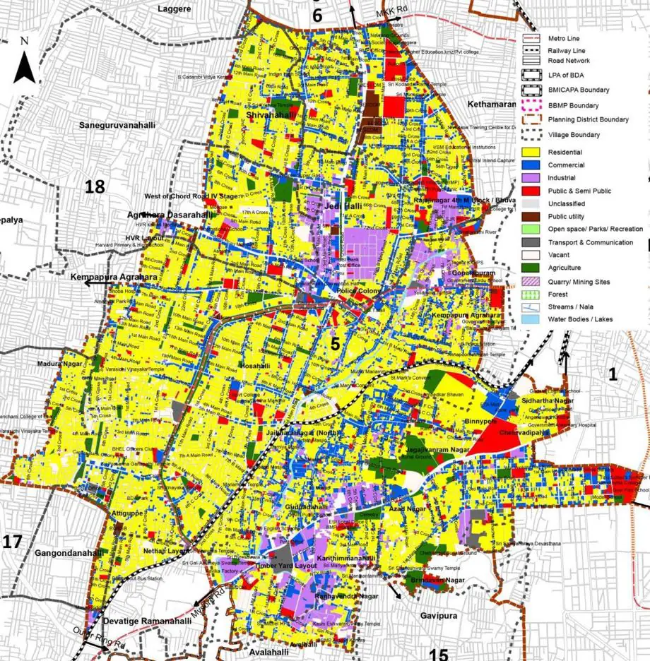
| Land use Category | Area (in Ha) | Percentage to Total Area (%) |
|---|---|---|
| Residential | 827.80 | 45.82 |
| Commercial | 225.16 | 12.46 |
| Industrial | 109.07 | 6.04 |
| Quarry/ Mining Sites | 0.00 | 0.00 |
| Public & Semi Public | 99.60 | 5.51 |
| Unclassified | 0.00 | 0.00 |
| Public Utility | 11.06 | 0.61 |
| Parks & Open Spaces | 74.00 | 4.10 |
| Transport & Communication | 326.59 | 18.08 |
| Vacant | 120.62 | 6.68 |
| Agriculture | 0.00 | 0.00 |
| Forest | 0.00 | 0.00 |
| Streams | 12.72 | 0.70 |
| Water Bodies | 0.00 | 0.00 |
| Total | 1806.63 | 100.00 |
| Land use Category | Area (in Ha) | Percentage To Total Developable Area (%) |
|---|---|---|
| Residential | 950.20 | 52.60 |
| Commercial | 79.92 | 4.42 |
| Industrial | 80.17 | 4.44 |
| Public & Semi Public | 86.61 | 4.79 |
| Unclassified | 0.00 | 0.00 |
| Public Utility | 10.61 | 0.59 |
| Parks & Open Spaces | 58.92 | 3.26 |
| Transport & Communication | 362.83 | 20.08 |
| Forest | 0.00 | 0.00 |
| Streams | 0.07 | 0.00 |
| Water Bodies | 0.00 | 0.00 |
| NGT Buffer | 177.31 | 9.81 |
| Total Developable Area | 1806.64 | , |
Total PD Area 1806.63 Ha. Source: Revised Master Plan 2031 (Draft) Volume-4.
Road Development Plan, Public Transport System, Multimodal Interchange Stations, Parks and Open Spaces, Protection and Rejuvenation of Lakes and Streams, Area Redevelopment, Heritage Area Protection and Conservation, Physical Infrastructure, Disaster Mitigation.