Demography
Population (2011)
231,647
Census 2011
Area
3406.8 Ha
34.07 sq.km
Gross Density
68 PPH
Persons per Hectare
Wards/Villages
4
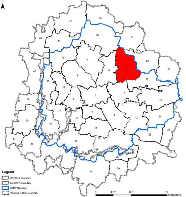
Within BBMP
North-eastern BBMP. 52% vacant land provides huge potential. Decadal growth 137.1%. Planned layouts within ORR, rapid unplanned development outside. Large lakes and flood-prone areas.
1. The PD comprises of 4 wards namely Horamavu (25), Ramamurthy Nagar (26), Banasawadi (27), and parts of Hoodi ward (54) namely Byrathi Hoodi (54), Bileshivale (Hoodi) (54) and Jinkethimmanahalli (Hoodi) (54).
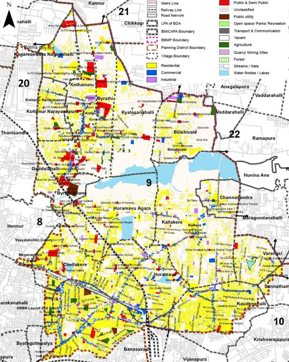
2. Outer Ring Road, Hennur Main Road, Hormavu/ Kalkere Main road, Dodda Bansawadi Main Road, Avalahalli Main Road are some of the major arterial roads forming the connectivity network within the planning district.
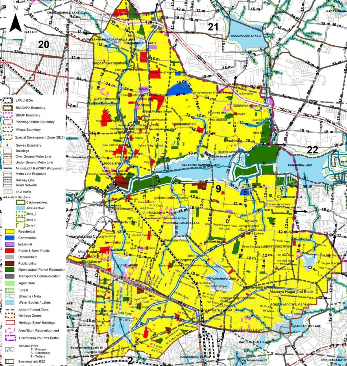
The Existing Land Use Map and Proposed Land Use Map for this PD are in the Planning District Report (PDF). Open the document and go to this PD’s section; use the List of Figures to find “PD 9 Existing Land Use Map” and “PD 9 Proposed Land Use Map”.
| Land use Category | Area (in Ha) | Percentage to Total Area (%) |
|---|---|---|
| Residential | 845.31 | 24.81 |
| Commercial | 102.89 | 3.02 |
| Industrial | 31.00 | 0.91 |
| Quarry/ Mining Sites | 0.00 | 0.00 |
| Public & Semi Public | 97.78 | 2.87 |
| Unclassified | 0.00 | 0.00 |
| Public Utility | 0.00 | 0.00 |
| Parks & Open Spaces | 26.23 | 0.77 |
| Transport & Communication | 344.37 | 10.11 |
| Vacant | 1774.27 | 52.08 |
| Agriculture | 0.00 | 0.00 |
| Forest | 0.00 | 0.00 |
| Streams | 0.00 | 0.00 |
| Water Bodies | 159.78 | 4.69 |
| NGT Buffer | 0.00 | 0.00 |
| Other | 24.19 | 0.71 |
| Total | 3406.80 | 100.00 |
| Land use Category | Area (in Ha) | Percentage To Total Developable Area (%) |
|---|---|---|
| Residential | 1872.10 | 54.95 |
| Commercial | 72.22 | 2.12 |
| Industrial | 10.22 | 0.30 |
| Quarry/ Mining Sites | 0.00 | 0.00 |
| Public & Semi Public | 104.25 | 3.06 |
| Unclassified | 0.00 | 0.00 |
| Public Utility | 0.00 | 0.00 |
| Parks & Open Spaces | 186.01 | 5.46 |
| Transport & Communication | 602.86 | 17.70 |
| Vacant | 0.00 | 0.00 |
| Agriculture | 0.00 | 0.00 |
| Forest | 0.00 | 0.00 |
| Streams | 0.00 | 0.00 |
| Water Bodies | 153.65 | 4.51 |
| NGT Buffer | 424.49 | 12.46 |
| Other | 0.00 | 0.00 |
| Total Developable Area | 3425.80 | , |
Total PD Area 3406.80 Ha. Source: Revised Master Plan 2031 (Draft) Volume-4.
Road Development Plan, Public Transport System, Multimodal Interchange Stations, Parks and Open Spaces, Protection and Rejuvenation of Lakes and Streams, Area Redevelopment, Heritage Area Protection and Conservation, Physical Infrastructure, Disaster Mitigation.