Demography
Population (2011)
219,837
Census 2011
Area
2765.9 Ha
27.66 sq.km
Gross Density
79 PPH
Persons per Hectare
Wards/Villages
6
Within BBMP
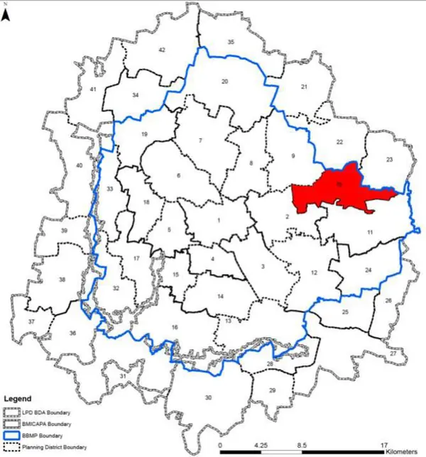
Eastern BBMP next to Whitefield. Houses ITI, ITPL, Phoenix Mall, SAIL. KR Puram Junction is city's most congested. 25% vacant land. Metro Phase 1 extension under implementation.
1. There are a total of 6 wards within the PD which are, Vijinapura (51), K.R Puram (52), Basavanapura (53), Hoodi (54), Devasandra(55) and A Narayanpura(56). Hoodi ward has four different spatial locations and only the main hoodi ward has been included in these PD. Rest three parts of Hoodi ward are adjacent to Ramamurthy Nagar (Ward 25) and Horamavu (Ward 26) falling in Planning District
9.
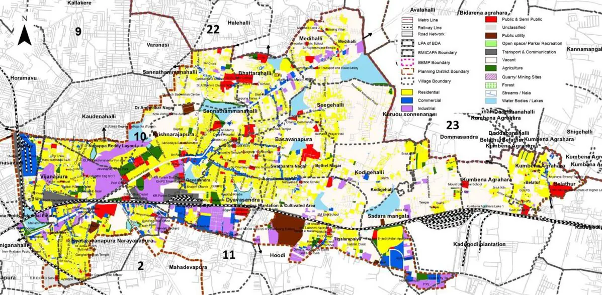
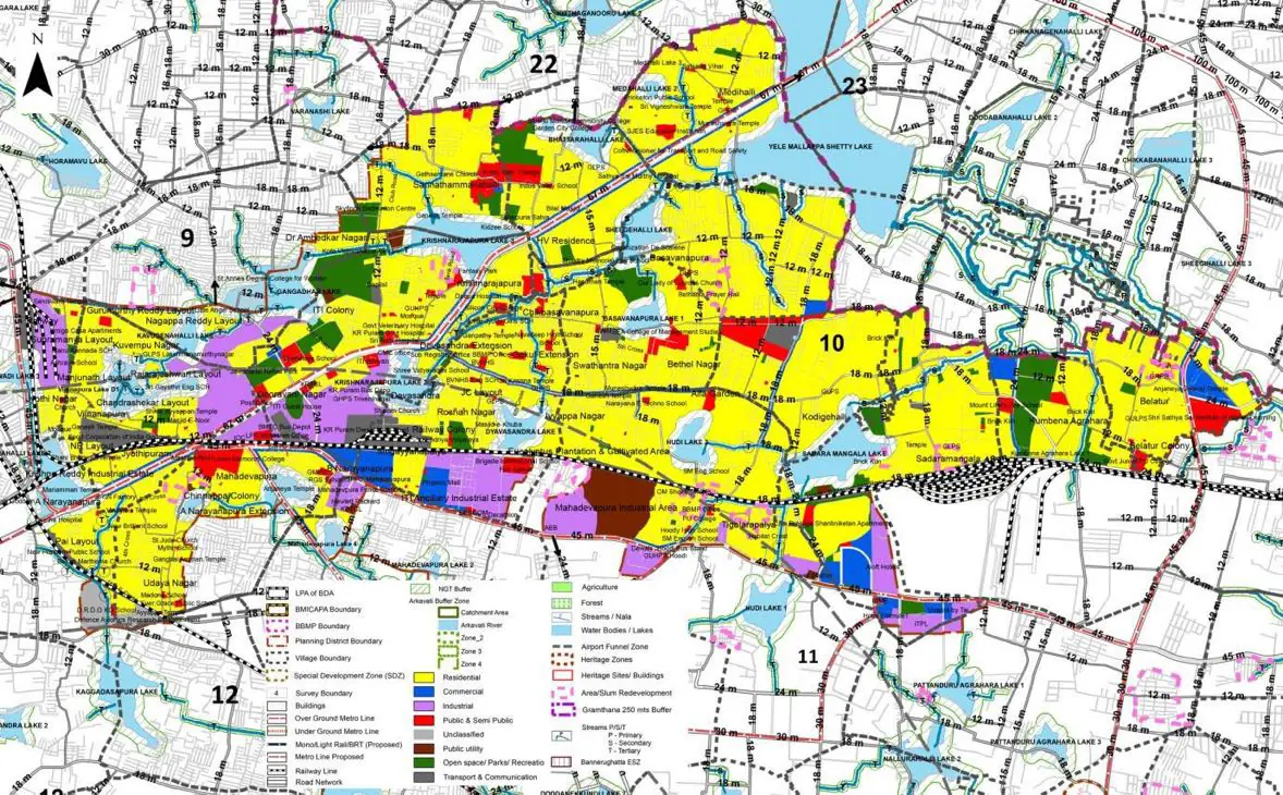
The Existing Land Use Map and Proposed Land Use Map for this PD are in the Planning District Report (PDF). Open the document and go to this PD’s section; use the List of Figures to find “PD 10 Existing Land Use Map” and “PD 10 Proposed Land Use Map”.
| Land use Category | Area (in Ha) | Percentage to Total Area (%) |
|---|---|---|
| Residential | 668.25 | 24.16 |
| Commercial | 128.62 | 4.65 |
| Industrial | 191.13 | 6.91 |
| Quarry/ Mining Sites | 0.00 | 0.00 |
| Public & Semi Public | 102.34 | 3.70 |
| Unclassified | 0.00 | 0.00 |
| Public Utility | 0.00 | 0.00 |
| Parks & Open Spaces | 61.68 | 2.23 |
| Transport & Communication | 319.19 | 11.54 |
| Vacant | 1108.14 | 40.06 |
| Agriculture | 0.00 | 0.00 |
| Forest | 0.00 | 0.00 |
| Streams | 0.00 | 0.00 |
| Water Bodies | 125.57 | 4.54 |
| NGT Buffer | 0.00 | 0.00 |
| Other | 60.02 | 2.17 |
| Total | 2765.94 | 100.00 |
| Land use Category | Area (in Ha) | Percentage To Total Developable Area (%) |
|---|---|---|
| Residential | 1329.16 | 48.05 |
| Commercial | 81.60 | 2.95 |
| Industrial | 178.96 | 6.47 |
| Quarry/ Mining Sites | 0.00 | 0.00 |
| Public & Semi Public | 97.08 | 3.51 |
| Unclassified | 0.00 | 0.00 |
| Public Utility | 0.00 | 0.00 |
| Parks & Open Spaces | 121.15 | 4.38 |
| Transport & Communication | 405.28 | 14.65 |
| Vacant | 0.00 | 0.00 |
| Agriculture | 0.00 | 0.00 |
| Forest | 0.00 | 0.00 |
| Streams | 0.00 | 0.00 |
| Water Bodies | 123.91 | 4.48 |
| NGT Buffer | 374.79 | 13.55 |
| Other | 54.21 | 1.96 |
| Total Developable Area | 2766.14 | , |
Total PD Area 2765.94 Ha. Source: Revised Master Plan 2031 (Draft) Volume-4.
Road Development Plan, Public Transport System, Multimodal Interchange Stations, Parks and Open Spaces, Protection and Rejuvenation of Lakes and Streams, Area Redevelopment, Heritage Area Protection and Conservation, Physical Infrastructure, Disaster Mitigation.