Demography
Population (2011)
20,016
Census 2011
Area
3209.5 Ha
32.09 sq.km
Gross Density
6 PPH
Persons per Hectare
Wards/Villages
11
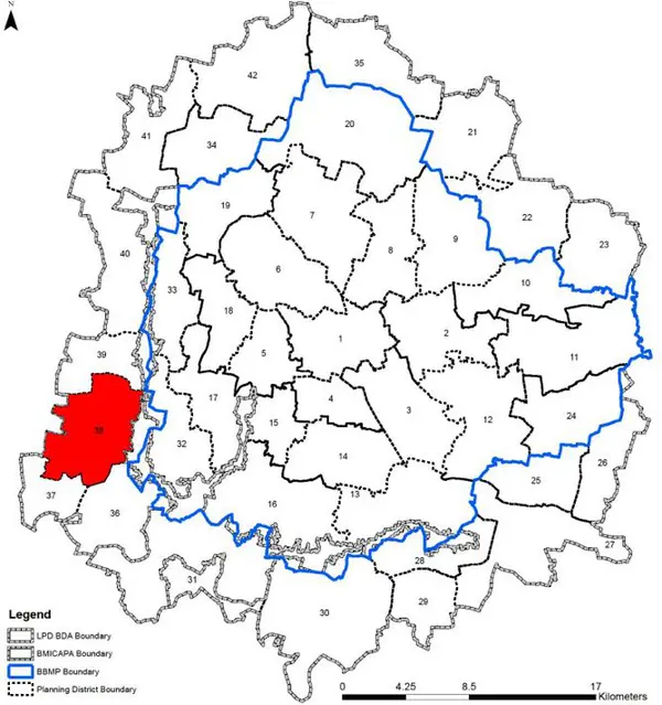
Outside BBMP
Western BMA, boundary BMICAPA (east) and Magadi LPA (west). 11 villages, Ramohalli & Sulikere GPs. BDA Sir Nadaprabhu Kempegowda Layout. Sulikere Forest, Ramohalli Kere, Bheemanakuppe Kere, Sulikere Lake. 69.6% decadal growth. 13 Govt schools. No BMTC depot.
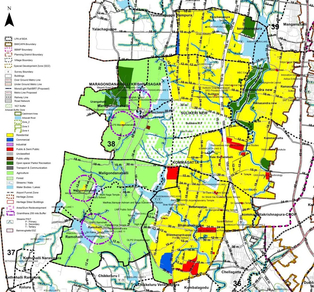
The Existing Land Use Map and Proposed Land Use Map for this PD are in the Planning District Report (PDF). Open the document and go to this PD’s section; use the List of Figures to find “PD 38 Existing Land Use Map” and “PD 38 Proposed Land Use Map”.
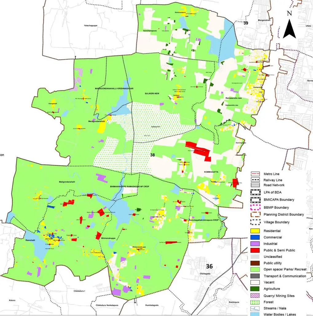
| Land use Category | Area (in Ha) | Percentage to Total Area (%) |
|---|---|---|
| Residential | 97.57 | 3.04 |
| Commercial | 6.10 | 0.19 |
| Industrial | 28.89 | 0.90 |
| Quarry/ Mining Sites | 7.06 | 0.22 |
| Public & Semi Public | 32.74 | 1.02 |
| Unclassified | 0.00 | 0.00 |
| Public Utility | 0.00 | 0.00 |
| Parks & Open Spaces | 10.91 | 0.34 |
| Transport & Communication | 67.08 | 2.09 |
| Vacant | 549.47 | 17.12 |
| Agriculture | 2024.19 | 63.07 |
| Forest | 213.75 | 6.66 |
| Streams | 0.00 | 0.00 |
| Water Bodies | 161.76 | 5.04 |
| NGT Buffer | 0.00 | 0.00 |
| Other | 8.67 | 0.27 |
| Total | 3209.49 | 100.00 |
| Land use Category | Area (in Ha) | Percentage To Total Developable Area (%) |
|---|---|---|
| Residential | 2047.65 | 63.80 |
| Commercial | 32.74 | 1.02 |
| Industrial | 0.00 | 0.00 |
| Quarry/ Mining Sites | 0.00 | 0.00 |
| Public & Semi Public | 82.16 | 2.56 |
| Unclassified | 0.00 | 0.00 |
| Public Utility | 0.00 | 0.00 |
| Parks & Open Spaces | 106.55 | 3.32 |
| Transport & Communication | 403.43 | 12.57 |
| Vacant | 0.00 | 0.00 |
| Agriculture | 0.00 | 0.00 |
| Forest | 30.49 | 0.95 |
| Streams | 0.00 | 0.00 |
| Water Bodies | 107.84 | 3.36 |
| NGT Buffer | 393.16 | 12.25 |
| Other | 4.81 | 0.15 |
| Total Developable Area | 3208.83 | , |
Total PD Area 3209.49 Ha. Source: Revised Master Plan 2031 (Draft) Volume-4.
Road Development Plan, Public Transport System, Multimodal Interchange Stations, Parks and Open Spaces, Protection and Rejuvenation of Lakes and Streams, Area Redevelopment, Heritage Area Protection and Conservation, Physical Infrastructure, Disaster Mitigation.